jps services
  • Home Page
  • GIS Training Courses
    • QGIS Training Courses
    • ArcGIS Training Courses
    • MapInfo Pro Training Courses >
      • MapBasic Training Course
  • About
  • Blog

Working with data from different GIS software systems

30/9/2019

0 Comments

 
If you are new to using GIS software or a casual user you may be surprised to learn that standard formats such as shape files do not contain sufficient information for successfully transferring data between systems.

For instance if you have been sent some shape files together with how they should appear in your system, and you are presented with something different when they are loaded, there is a simple explanation.

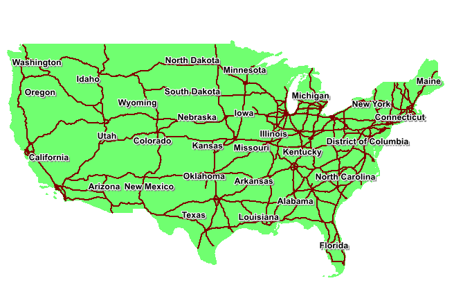
Here is a screen shot of how two layers should display in your system.
Picture
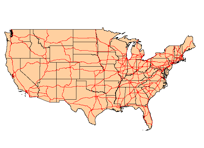
And here is how it may look if loaded in just a default shape format.
Picture

Read More
0 Comments

Why GIS has a separate file management system

20/9/2019

0 Comments

 
The Microsoft windows file management system was developed to enable users to easily save, copy, delete and move files within a hierarchical folder structure. Each file type is identified by a dot definition system. So a Paint program file could have a .png, bmp or .gif format. A text file could have a. .doc format.  An excel spreadsheet could have a ,xls format. This file management system works very well for file types which generally consist of a single file format, however GIS formats such as Esri shape files or MapInfo tab files are made up of a number of different file types. This often presents a problem for casual GIS users when copying, deleting, moving or saving such files through a file management system such as Microsoft Windows. Often only the .tab or shp file element is copied which means that the specified file will not load into a GIS system.
Picture
In the above screen shot from the Windows file management system the shape file format can be seen to consist of four files, all of which are needed to produce a map layer in a GIS.
ESRI have addressed this problem with the introduction of ArcCatalog, which is there own proprietary file management system. Within ArcCatalog various filetypes are stored is such a way as to enable the user to access the various elements as if they were a single file. Additional features enable users to preview maps within ArcCatalog as well as the ability to drag and drop files into the map surface.
Picture

Read More
0 Comments

    Author

    Joe Short BSc has been involved with various mapping solutions for over twenty years.  If you are considering implementing a GIS  or have ArcGIS Pro, MapInfo Pro or QGIS training requirements, jps services would be happy to be of assistance to your organisation. 

    Archives

    April 2020
    March 2020
    October 2019
    September 2019
    August 2019
    July 2019
    March 2019
    November 2018
    October 2018
    August 2018
    July 2018
    November 2017
    October 2017
    September 2017
    July 2017
    February 2017
    January 2017
    December 2016
    November 2016
    October 2016
    May 2016
    February 2016
    September 2015
    August 2015
    April 2015
    February 2015
    November 2014
    October 2014
    July 2014
    June 2014
    May 2014
    March 2014
    February 2014
    December 2013
    November 2013
    October 2013
    September 2013
    August 2013
    June 2013
    May 2013
    April 2013
    February 2013
    December 2012
    October 2012
    September 2012
    August 2012
    July 2012

    Categories

    All
    Arc Gis
    Arcview
    Autodesk
    Cad
    Gis Training
    Local Government
    Mapbasic
    Mapinfo
    Quantum Gis
    Relational Databases
    Saga Gis

    RSS Feed