In this final blog about automatically creating a series of maps in an atlas type program, we will look at adding some text options for the user.
The first option, regarding adding text to a series of maps, is to add a text box so the user can put text on to one or more maps. This could be achieved by adding an additional ribbon tab for adding text to the map. In previous versions of the Atlas program updating the organisation details was an option in which a dialogue box automatically appeared when a new selection was created. Whilst this option enabled updates to occur to organisational data it may be overkill if changes rarely occur. By adding a tab, where this option could be accessed as an when necessary, would therefore be an acceptable alternative. This is option is shown in the graphics below.
The first option, regarding adding text to a series of maps, is to add a text box so the user can put text on to one or more maps. This could be achieved by adding an additional ribbon tab for adding text to the map. In previous versions of the Atlas program updating the organisation details was an option in which a dialogue box automatically appeared when a new selection was created. Whilst this option enabled updates to occur to organisational data it may be overkill if changes rarely occur. By adding a tab, where this option could be accessed as an when necessary, would therefore be an acceptable alternative. This is option is shown in the graphics below.
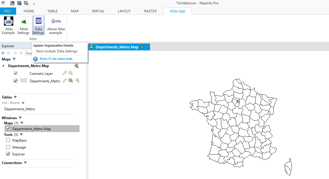
When the Data option is selected the dialogue box appears with an additional option of a text box for inputting additional information in the map.
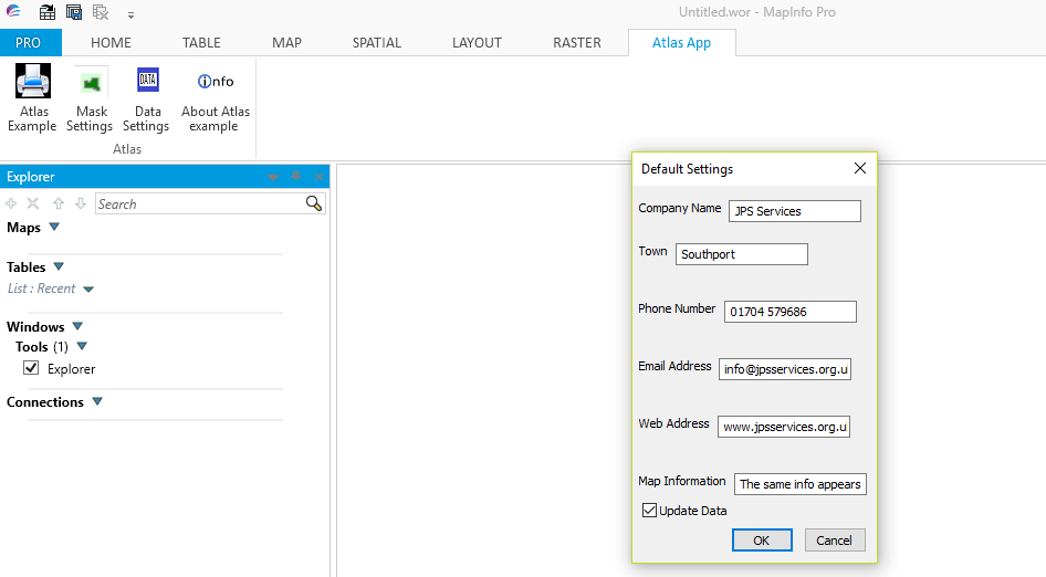
This text box could be used to input text relevant to all the maps in a series. However, this option would not be suitable for customised statements which would be relevant to individual maps. For this option you will need to add MapBasic code into the Atlas program. This option would be appropriate if you have data in your tables which you would like to display in your map series. We can achieve this by updating the code in the LayoutPortrait and LayoutLandscape modules.
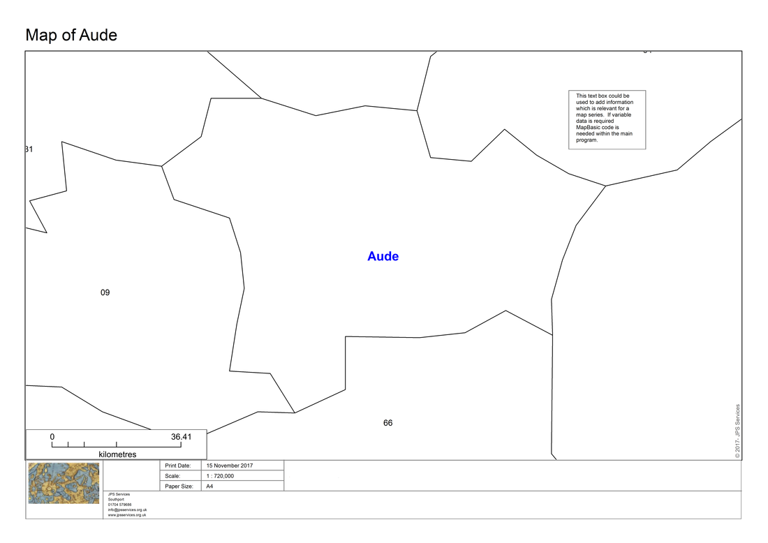
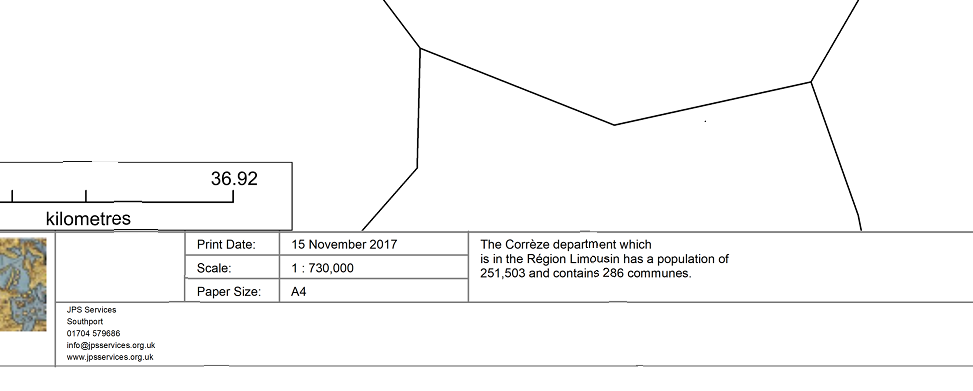
Here is the result of some standard text included within a section from the map of French departments. This French departmental map was used in the original version of the program called PrintLayout developed by Egge-Jan Pollé.
Here is the result of some standard text included within a section from the map of French departments. This French departmental map was used in the original version of the program called PrintLayout developed by Egge-Jan Pollé.
We could also add some text into a map series which contains variable data by creating code with MapBasic. Here is an example using data from the map's browser.
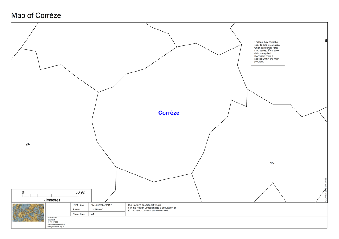
Here is a close up of the variable text.
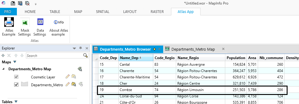
Here is the browser data from which this information is derived.
 RSS Feed