When you save a style with QGIS it is saved within a file ending in the .qml format. Then whenever you want to use this style in a new layer you can load it from file. The styles need to be relevant to the type of layer in other words a point, line or polygon layer.
Creating new symbols can initially seem daunting if you have never tried it. However, there are many symbols for points, lines and polygons within the library provided by QGIS which can be viewed or modified to meet your requirements. These symbols may also help you understand how to create completely new ones more suited to your specific needs.
Understanding how the symbol style is created can be demystified if you pan up and down the layers which make up the symbol design. For instance, some of the line symbols which are provided relate to different types of road and rail symbol styles. For example to create a dashed parallel line to represent a railway line may consist of several symbol layers consisting of black and white lines one of top of the other.
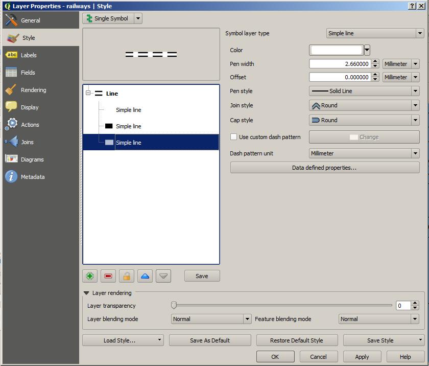
Simple white line with pen width 2.66 mm and pen style solid line.
The highlighted layer is a simple white line with a 2.66 mm pen width and a solid line pen style which is the widest line. The button with the green plus sign lets you add a new layer. The button with the red minus sign lets you remove the highlighted layer. You can also pan the highlighted layer up and down by using the blue triangles buttons.
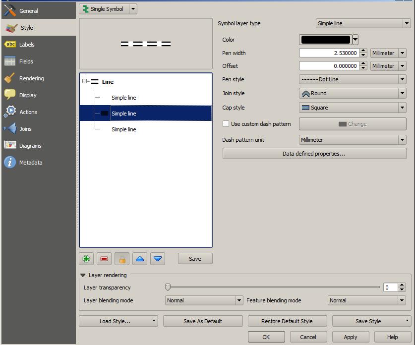
Simple black line with pen width with 2.53 mm and pen style dot line
The middle layer has a black dotted line pen style and a 2.53 mm pen width which helps to create the effect of parallel dashed lines when a thinner white line is added as the uppermost layer.
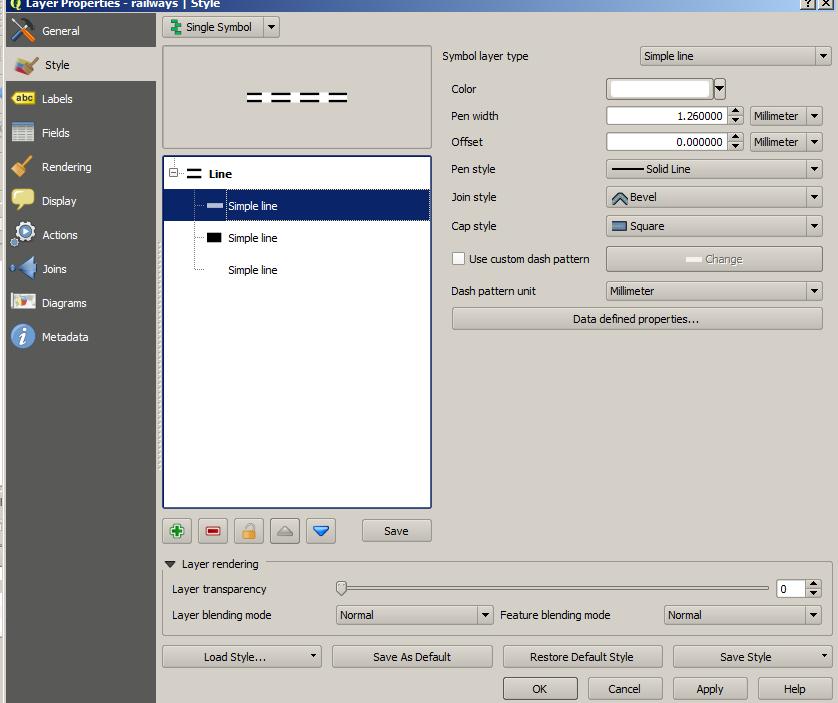
Simple white line with pen width 1.26 mm and pen style solid line
This thinner top layer is another white line which is narrower at 1.26 mm pen width and a solid line pen style and creates the final effect required. Namely, the combination of the three layers creates the dotted line effect. You can change any element of these layers or add new layers at any level to create a different effect. Next to the buttons which enable you to add, delete and move layers is the Save button. This Save button enables you to save your new symbol in a symbol library for later use.
Finally, you may find that the library contains all the symbols that you could require. However, the ability to create new symbols or modify current ones is not a difficult task and may enable you to produce maps which are illustrated with symbols more meaningful for your audience.
Finally, you may find that the library contains all the symbols that you could require. However, the ability to create new symbols or modify current ones is not a difficult task and may enable you to produce maps which are illustrated with symbols more meaningful for your audience.
 RSS Feed