This program was developed to enable the user to automatically iterate through a series of polygons in a map layer in order to produce A4 or A3 maps.
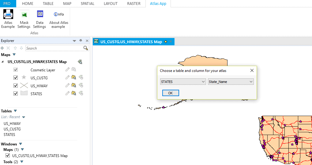
The user can choose which maps to print from the option dialogue box which shows all the attributes of a specific layer. For example, if the States layer is chosen the user would choose the State_Name attribute.
The user can choose which maps to print from the option dialogue box which shows all the attributes of a specific layer. For example, if the States layer is chosen the user would choose the State_Name attribute.
When the user clicks on the OK button a second dialogue box appears.
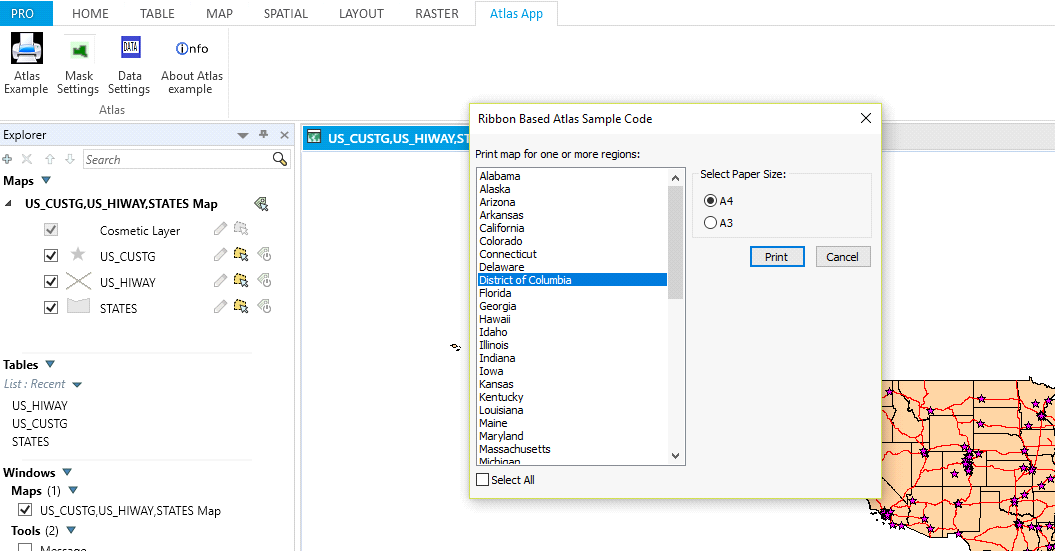
The user can choose from one to all of the listed attributes which is derived from the State_Name attribute column. When the user clicks on the Print button a series of maps is produced according to the selection.
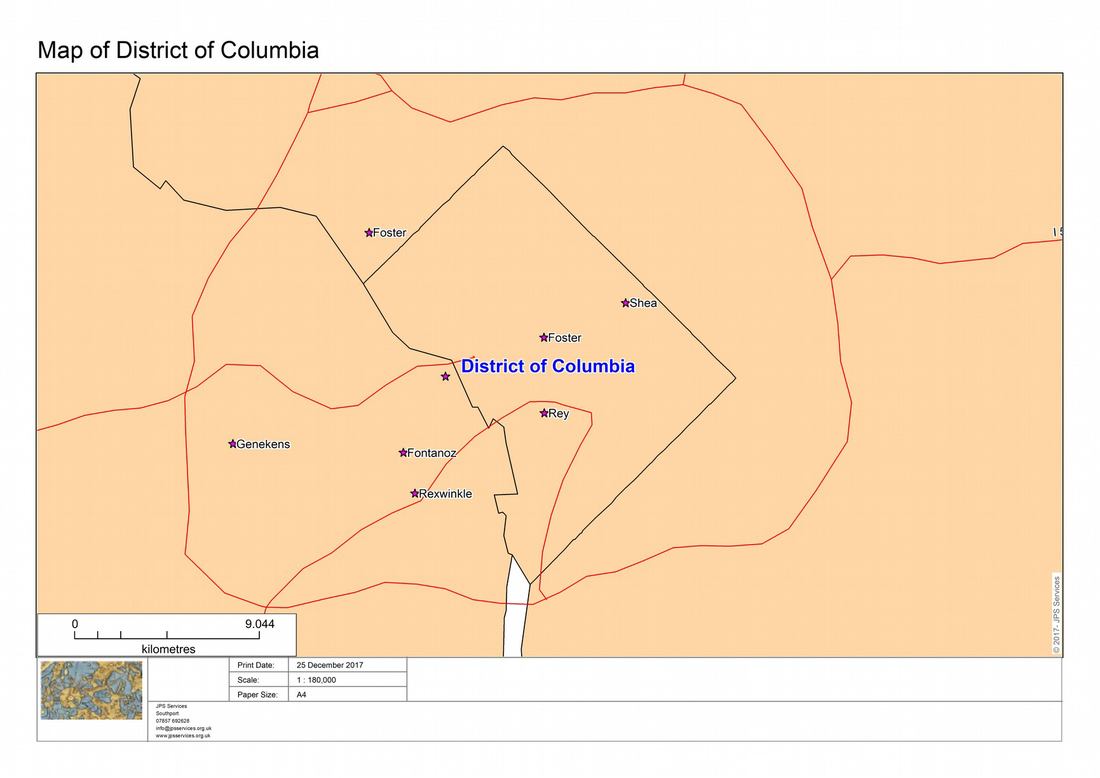
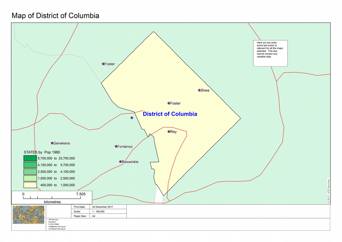
Here is an example.
Here is an example.
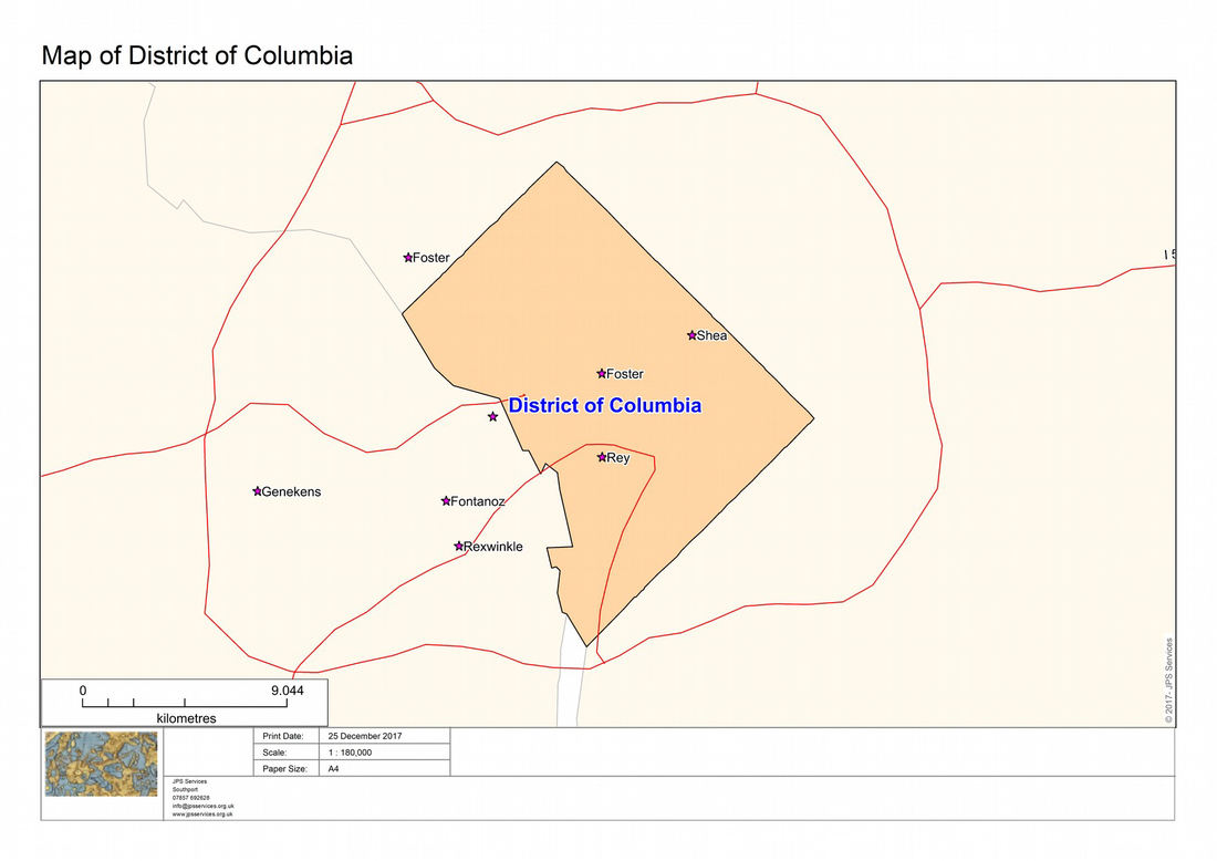
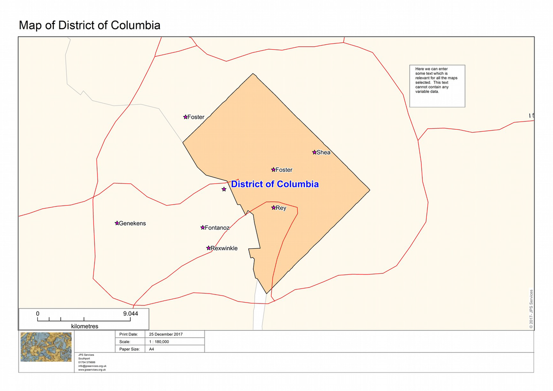
Next we could apply a mask to make the selected regions more defined. Choose the Mask tab and click OK on the default settings.
Here is the same map of Columbia with a mask.
Here is the same map of Columbia with a mask.
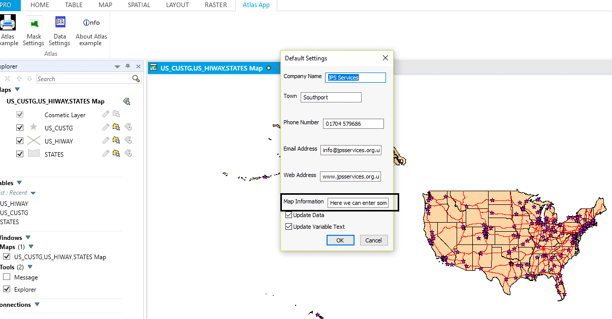
The default company settings are currently set to JPS Services. The module AtlasDefaultSettings should be updated to the appropriate company details. The company logo would also need to be replaced in the Images file. The Data Settings box allows the user to change some or all of the information on company details for the current session. There are also three options at the bottom of the dialogue. The Update Data option is there if you wish to change any text boxes. The Update Variable Data puts
additional information into the map from attribute data. This could be used to record changes in sales performance for example for each area. This would involve updating the code within the ModifyTextPortrait and ModifyTextLandscape modules. Currently this code is set up for the Departments_Metro and Regions_Metro. Finally the Map Information text box allows the user to enter text which will appear in a box on each map. This has to be text which is relevant to all the maps as it does not support variable
attribute data.
Here is an example of some text entered into the Map Information text box.
Here is the map with the text box.
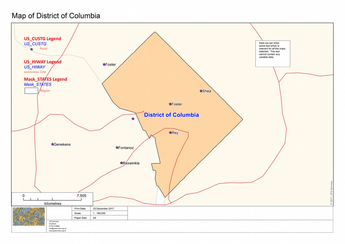
Next we could add a legend to the map as in the following screen shot.
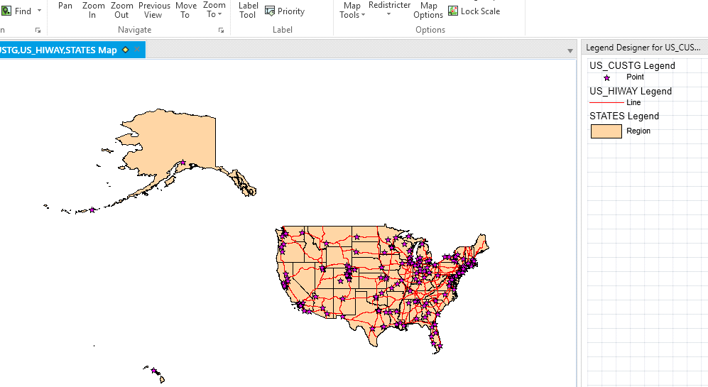
If the user now creates the same map a legend will be automatically added to the map. If several maps are created each will contain a legend.
Similarly if the user creates a thematic layer then a map would be automatically created as in the following screen shot.
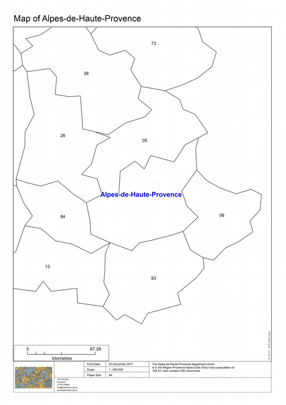
To show the variable data option you would need to load the French regions and metro layers. If you have previously loaded other maps and iterated through them you need to exit the Atlas program before starting this section. Also make sure that you close the Mask layer if you have chosen this option. Otherwise you may not get a satisfactory result! Load the French maps for departments and regions. To enable the variable data option click on the Data Settings tab and click OK on the default settings.
If you then select either the regions or departments maps you will find that variable data has been added into each map.
Here is an example of the output for the departments map.
If you then select either the regions or departments maps you will find that variable data has been added into each map.
Here is an example of the output for the departments map.
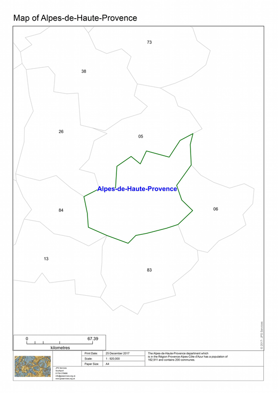
We could enhance this map by adding a mask as in the next example.
Some improvements to the program would include including an ability to recognise when the user closes one set of maps and opens new ones. This would also include closing any elements in memory which could impact adversely on the next set of maps. Also the cartographic element is very rudimentary.
The program currently is hard coded and only works with base maps. If a style override is applied this is not included in the maps generated by the program. The ability to be able to read this kind of data regarding layer information and apply it to the map series would be very useful.
You can obtain the Atlas program and the related MapInfo Pro tab files from the Pitney Bowes community download page with this link
 RSS Feed