jps services
  • Home Page
  • GIS Training Courses
    • QGIS Training Courses
    • ArcGIS Training Courses
    • MapInfo Pro Training Courses >
      • MapBasic Training Course
  • About
  • Blog

QGIS - Geoprocessing tools

6/5/2014

0 Comments

 
If you decide to use the geoprocessing tools within QGIS, you may find that certain fields within the attribute data are not valid because they are not correctly updated after you have completed the process. Take, for example, the following problem. You have a map of France which shows all the Departments within the country. This layer also contains an attribute data column relating to the Regions of France called code_regio containing the regional code. You would like to create a layer of the regions from the attribute data column code_regio which contains these regional codes.   We can use this data, which is within the Department layer's attribute table, to create our new regions layer by dissolving the relevant department polygons.
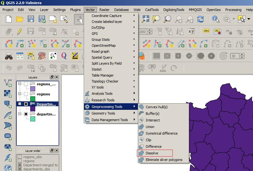
QGIS Geoprocessing Tools Option
You can use the Dissolve tool within the Geoprocessing Tools option to dissolve the departmental polygons to create a new layer of regional polygons. You can access these tools from the top main menu under the Vector option.

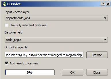
Dissolve dialogue box

Read More
0 Comments

    Author

    Joe Short BSc has been involved with various mapping solutions for over twenty years.  If you are considering implementing a GIS  or have ArcGIS Pro, MapInfo Pro or QGIS training requirements, jps services would be happy to be of assistance to your organisation. 

    Archives

    April 2020
    March 2020
    October 2019
    September 2019
    August 2019
    July 2019
    March 2019
    November 2018
    October 2018
    August 2018
    July 2018
    November 2017
    October 2017
    September 2017
    July 2017
    February 2017
    January 2017
    December 2016
    November 2016
    October 2016
    May 2016
    February 2016
    September 2015
    August 2015
    April 2015
    February 2015
    November 2014
    October 2014
    July 2014
    June 2014
    May 2014
    March 2014
    February 2014
    December 2013
    November 2013
    October 2013
    September 2013
    August 2013
    June 2013
    May 2013
    April 2013
    February 2013
    December 2012
    October 2012
    September 2012
    August 2012
    July 2012

    Categories

    All
    Arc Gis
    Arcview
    Autodesk
    Cad
    Gis Training
    Local Government
    Mapbasic
    Mapinfo
    Quantum Gis
    Relational Databases
    Saga Gis

    RSS Feed