Legacy Layout v Layout Designer code
MapInfo Pro provides some information in MapBasic Help concerning legacy code for creating layout windows. However, some features within the legacy layout, available in earlier versions of MapInfo, are no longer supported. For instance, earlier versions of MapInfo had a graph function. Graphs are no longer supported so any code to include graphs in a layout is now redundant and needs to be removed. If the code is left in, at best you will end up with a blank space in the layout, or MapInfo may try to fill the space with a map window frame.
Another issue concerning coding is thematic and cartographic legend layer support for legacy code. If you look up cartographic legend in MapBasic Help you will find code which was developed for the legacy layout format. Below is a section from the Create Cartographic Legend section.
Another issue concerning coding is thematic and cartographic legend layer support for legacy code. If you look up cartographic legend in MapBasic Help you will find code which was developed for the legacy layout format. Below is a section from the Create Cartographic Legend section.
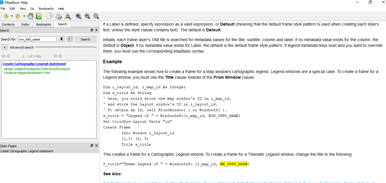
The first section of this code which should create a Cartographic Legend window creates errors when run in MapInfo Pro. The second section of code should create a frame for a Thematic Legend window. However the recommendation to create a frame for a Thematic Legend window, by changing the title to the following does not work as it contains errors:-
S_title="Theme Legend of " + WindowInfo (I_map_id, WW_INFO_NAME)
By using a note statement you can ascertain the legend name using the first section of the code snippet as shown in the screen below.
S_title="Theme Legend of " + WindowInfo (I_map_id, WW_INFO_NAME)
By using a note statement you can ascertain the legend name using the first section of the code snippet as shown in the screen below.
 RSS Feed