A useful feature within QGIS is the Actions function. This enables you to automate actions which are repetitive. An example would be associating an attribute field on your map layer to your web browser in order to create a search, based on that attribute. To enable this function you first to need to select a specific layer which contains the attribute you intend to link to your search engine enquiry.
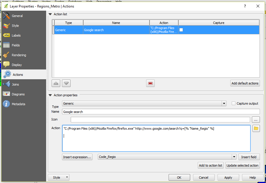
In QGIS choose the layer you want to use in conjunction with the Action function. Double click on the layer to bring up the Properties Dialogue. Choose the Actions option from the left hand menu. You may not have any actions in the Action List. If this is the case you can load the defaults by clicking on the Add default actions button.
In QGIS choose the layer you want to use in conjunction with the Action function. Double click on the layer to bring up the Properties Dialogue. Choose the Actions option from the left hand menu. You may not have any actions in the Action List. If this is the case you can load the defaults by clicking on the Add default actions button.
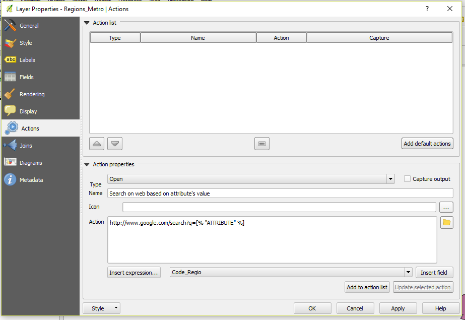
Choose the last item in the list: “Search on web based on attribute's value.” This example code enables you to click on the map and then perform an automatic search for the relevant web page associated with the selected attribute. In the Actions properties section is the code required for this action:-
http://www.google.com/search?q=[% "ATTRIBUTE" %]
The first part of the code refers to the google search parameter. If you enter any search into Google the first part of the search will be similar to http://www.google.com/search?q= followed by your search term then lots of additional information produced by Google.
If the default actions are not listed in the dialogue box,, click on the Add default actions which will load them. Choose the Search on web based on attribute's value action option.
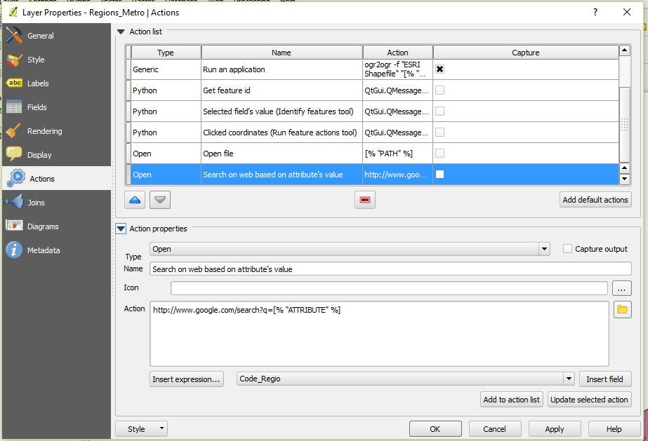
The [%”ATTRIBUTE”%] part is needed by QGIS to search for the selected attribute. To generate a meaningful action you need to change the data after the q= by selecting an attribute to search on. Choose an attribute from the drop down list. Then highlight the default code [% "ATTRIBUTE" %] in order to replace it. Next click on the Insert field button to replace the default text with the correct attribute data. Then update the code by clicking on the Update selected action button. Click on the Apply and OK buttons.

Select the Action button in the top menu in QGIS and then select the Search on web based on attribute's value option from the drop down list.
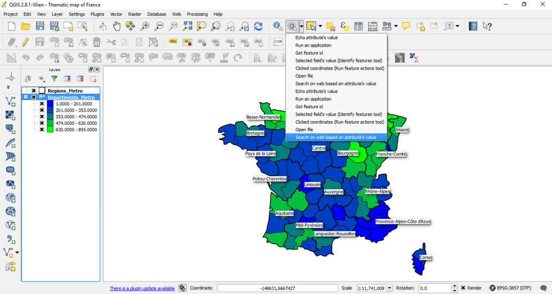
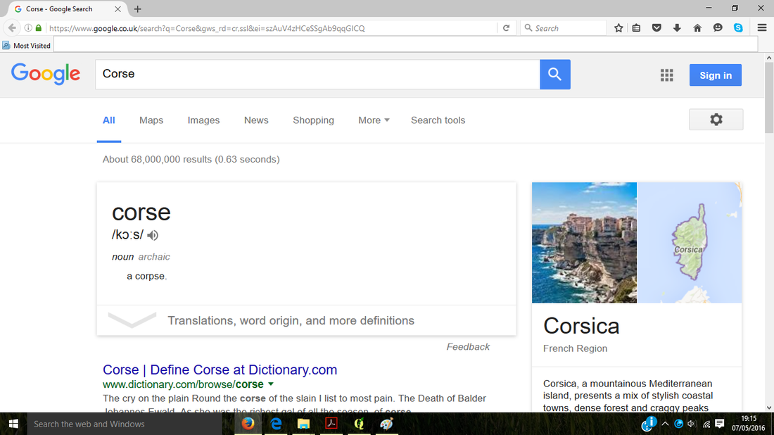
Now clicking on the map will cause a web page to open related to the attribute data from that part of the map. Below is the web page automatically displayed when clicking on Corsica on the map.
If you try out this example and QGIS brings up an error message you may have to set out the full path to your web browser. For example "C:/Program Files (x86)/Mozilla Firefox/firefox.exe" http://www.google.com/search?q=[% "Name_Regio" %].
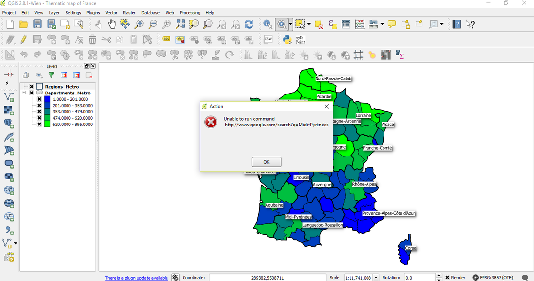
If you have difficulty making this action work using the full path should solve the problem.
 RSS Feed