jps services
  • Home Page
  • GIS Training Courses
    • QGIS Training Courses
    • ArcGIS Training Courses
    • MapInfo Pro Training Courses >
      • MapBasic Training Course
  • About
  • Blog

Rendering a layer with rule based symbology

1/3/2014

0 Comments

 
Some desktop GIS now support ruled based symbology as a method of rendering a vector layer. If your GIS supports this option you can convert a vector layer from simple points, lines and polygons into something much more meaningful.
Here is an Ordnance Survey sample prior to applying the rule based option. As you can see the layer shows a plain black and white polygon map without any of the features being differentiated depending upon their underlying layer attribute data.  
Ordnance Survey Sample Courtesy of Ordnance Survey
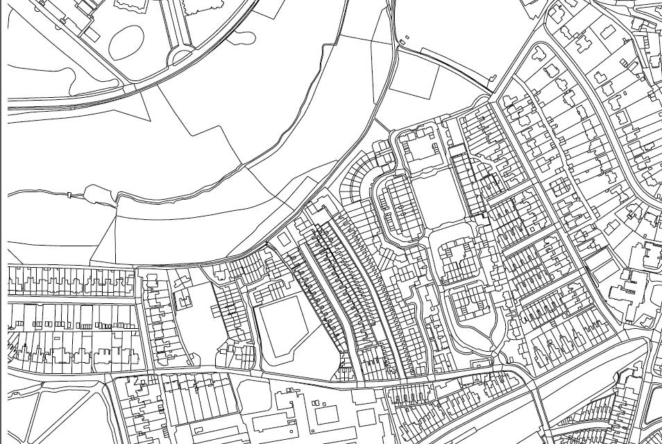
Ordnance Survey sample map. (Copyright OS)
Using the rule based option enables us to select columns from the attribute table and use them to render the layer. This is achieved by assigning relevant colours to each individual attribute type according to predefined colouring rules. Some attributes will involve more choices than others. This is where using the AND and OR functions ensure that the correct attributes are rendered according to the rules we have decided upon.
Attribute table highlighting descGroups, desrTerms  and make columns
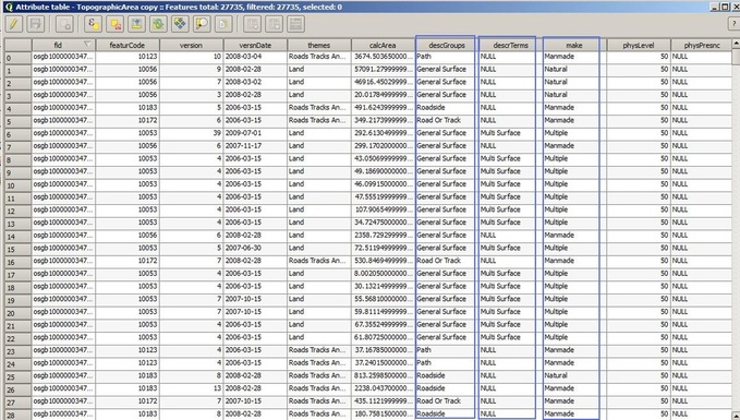
Attribute data table highlighting descGroups, descrTerms and make columns
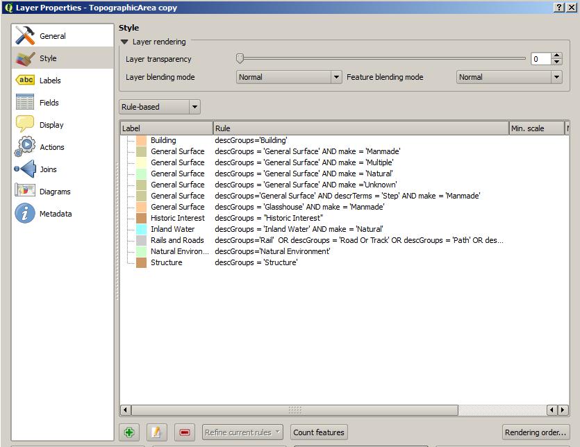
Applying these rules to our map in this example creates the layer in the correct colours according to OS rules. Having created the rules it also important to save them to a file so that they can be recalled as required.   
Picture
Having applied the above rules based option our map is now rendered as in the following example.
Ordnance Survey map rules based rendered
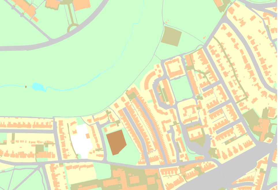
Ordnance Survey sample map (Copyright OS)
If you would like to further explore how GIS could help your organisation jps services offers one and two day training courses in QGIS, ArcGIS and MapInfo.


0 Comments

Your comment will be posted after it is approved.


Leave a Reply.

    Author

    Joe Short BSc has been involved with various mapping solutions for over twenty years.  If you are considering implementing a GIS  or have ArcGIS Pro, MapInfo Pro or QGIS training requirements, jps services would be happy to be of assistance to your organisation. 

    Archives

    May 2025
    March 2025
    March 2024
    October 2023
    September 2023
    August 2023
    March 2023
    April 2020
    March 2020
    October 2019
    September 2019
    August 2019
    July 2019
    March 2019
    November 2018
    October 2018
    August 2018
    July 2018
    November 2017
    October 2017
    September 2017
    July 2017
    February 2017
    January 2017
    December 2016
    November 2016
    October 2016
    May 2016
    February 2016
    September 2015
    August 2015
    April 2015
    February 2015
    November 2014
    October 2014
    July 2014
    June 2014
    May 2014
    March 2014
    February 2014
    December 2013
    November 2013
    October 2013
    September 2013
    August 2013
    June 2013
    May 2013
    April 2013
    February 2013
    December 2012
    October 2012
    September 2012
    August 2012
    July 2012

    Categories

    All
    Arc Gis
    Arcview
    Autodesk
    Cad
    Gis Training
    Local Government
    Mapbasic
    Mapinfo
    Quantum Gis
    Relational Databases
    Saga Gis

    RSS Feed