Geographic Information Systems (GIS) play a crucial role in modern decision-making processes by allowing us to visualize, analyse, and interpret spatial data. QGIS (Quantum GIS) is a popular open-source GIS software that empowers users to create and manage spatial data easily. In this beginner-friendly guide, we'll explore how to query and filter spatial data from QGIS projects using PHP, a server-side scripting language.
Prerequisites
Before we begin, you'll need to have the following in place:
1. QGIS Installed: Make sure you have QGIS installed on your computer. You can download it from the QGIS website.
2. PHP Installed: PHP should be installed on your server. You can download PHP from the PHP official website.
3. Spatial Data: You should have a QGIS project (.qgs) with spatial data layers that you want to query and filter.
Setting Up QGIS Project
1. Create or Open a QGIS Project: Launch QGIS and create a new project or open an existing one containing your spatial data layers.
2. Add Spatial Layers: Import or add the spatial data layers you want to work with into your project.
3.Save the Project: Save your QGIS project to ensure you don't lose any changes.
Writing PHP Code
Now, let's write some PHP code to query and filter the spatial data from your QGIS project. We'll use the OGR PHP library, which provides functions to work with geospatial data.
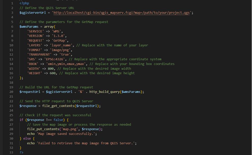
In this PHP code, we utilize the QGIS Server's Web Map Service (WMS) capabilities to request a map image. You should customize the parameters such as layer name, coordinate system (CRS), bounding box (BBOX), image dimensions (WIDTH and HEIGHT), and others to match your specific requirements.
Running the PHP Script
Running the PHP Script
- Save the code above in a .php file (e.g., query_spatial_data.php).
- Upload the PHP file to your OSGeo4W apache web server.
- Access the PHP script through a web browser or execute it via the command line.
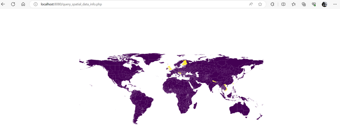
- You will see the map image saved in the current directory or receive a message if there's an issue
Conclusion
With this beginner's guide, you've learned how to query and filter spatial data from QGIS projects using PHP. GIS can be a powerful tool for various applications, including environmental analysis, urban planning, and more. As you become more comfortable with GIS and PHP, you can explore advanced techniques and further customize your spatial data workflows to suit your specific needs.
With this beginner's guide, you've learned how to query and filter spatial data from QGIS projects using PHP. GIS can be a powerful tool for various applications, including environmental analysis, urban planning, and more. As you become more comfortable with GIS and PHP, you can explore advanced techniques and further customize your spatial data workflows to suit your specific needs.
 RSS Feed