Geographic Information Systems (GIS) play a crucial role in various fields such as urban planning, environmental management, and location-based services. One common task in GIS is collecting and processing user input through web forms. In this beginner's guide, we will explore how to process form data with PHP, a server-side scripting language widely used for web development.
Understanding the Basics
Before we dive into the code, let's clarify a few fundamental concepts:
HTML Forms
HTML forms are a way for users to input data on a webpage. They consist of various input elements like text fields, checkboxes, radio buttons, and submit buttons. Users fill out these forms, and when they submit the data, it is sent to a server for processing.
PHP
PHP is a server-side scripting language that can handle form data, process it, and interact with databases. It is often used in conjunction with HTML to create dynamic web applications.
POST and GET Methods
HTML forms can use two primary methods to send data to the server: POST and GET. In this guide, we'll focus on the POST method, which is more secure and appropriate for handling sensitive information like user passwords.
Setting Up the HTML Form
Let's start by creating a simple HTML form that collects geographic data. For example, we'll create a form to collect a location name and coordinates (latitude and longitude):
In this code, we have created a simple HTML form with fields for name, latitude, and longitude. The action attribute specifies the PHP script that will process the data (in this case, `process_data.php`), and we've set the method attribute to "post" to use the POST method.
Processing Form Data with PHP
Now, let's create the PHP script `process_data.php` to handle the form data:
Processing Form Data with PHP
Now, let's create the PHP script `process_data.php` to handle the form data:
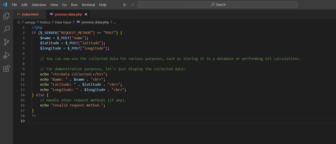
In this PHP script, we first check if the request method is POST, which ensures that the form data is being submitted. We then use the `$_POST` superglobal to retrieve the values entered in the form fields and store them in variables.
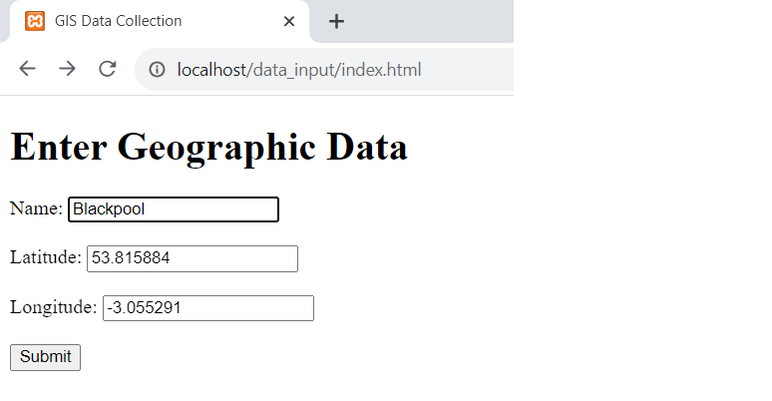
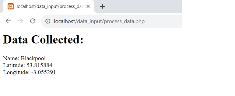
Now, you can use this collected data for various GIS-related tasks, such as storing it in a database, performing spatial analysis, or displaying it on a map. In the following images we show the name, latitude and longitude fields completed. Once the Submit button is pressed the process_data.php code displays the results in a new page. Of course in a real application we would save this information to a relational database rather than just displaying the results.
Now, you can use this collected data for various GIS-related tasks, such as storing it in a database, performing spatial analysis, or displaying it on a map. In the following images we show the name, latitude and longitude fields completed. Once the Submit button is pressed the process_data.php code displays the results in a new page. Of course in a real application we would save this information to a relational database rather than just displaying the results.
Processing form data with PHP is an essential skill for GIS beginners, as it allows you to gather user input and manipulate geographic information effectively.
With this guide, you should have a solid foundation for creating HTML forms, collecting data, and using PHP to process and work with that data in your GIS applications. As you continue to explore GIS development, you'll find countless opportunities to leverage these skills to build powerful and interactive web-based geographic applications. Happy coding!
 RSS Feed