For GIS enthusiasts venturing into the world of web development with PHP, mastering control structures is essential. These structures empower you to build dynamic and interactive applications that can manipulate, analyse, and visualise geographic data. In this blog, we'll explore three fundamental PHP control structures—If statements, loops, and switches—and how they can be harnessed to enhance your GIS-based web projects.
If Statements: Directing Your GIS Web Application
If statements allow your PHP code to make decisions based on certain conditions. In a GIS context, these conditions could involve spatial relationships, attribute values, or user interactions. For instance, you might use an if statement to determine whether a certain point lies within a specific geographic area:
If statements allow your PHP code to make decisions based on certain conditions. In a GIS context, these conditions could involve spatial relationships, attribute values, or user interactions. For instance, you might use an if statement to determine whether a certain point lies within a specific geographic area:
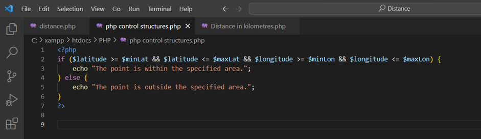
This example showcases how if statements can guide your GIS web application's behaviour based on spatial conditions.
Loops: Iterating Through Geographic Data
Loops enable you to repeat a block of code multiple times, which is particularly valuable when dealing with extensive GIS datasets. Imagine you have a list of cities with attributes, and you want to display information for each city. A loop can simplify this process:
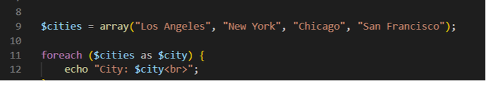
This snippet demonstrates how a loop can help you process and display GIS-related data efficiently.
Switches: Navigating GIS Scenarios
Switch statements are useful when you want to evaluate multiple possible outcomes based on a single value. In a GIS scenario, this could involve categorizing features based on attribute values or making decisions related to data visualization. For instance:
Switches: Navigating GIS Scenarios
Switch statements are useful when you want to evaluate multiple possible outcomes based on a single value. In a GIS scenario, this could involve categorizing features based on attribute values or making decisions related to data visualization. For instance:
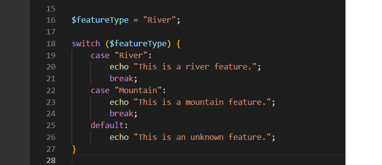
This code snippet exemplifies how switches can help you manage GIS data classifications or visualize diverse geographic features.
Enhancing Your GIS Web Projects
Incorporating if statements, loops, and switches into your PHP code empowers your GIS web applications with dynamic behaviours and interactions. Whether you're validating spatial conditions, iterating through extensive datasets, or making decisions based on attribute values, these control structures provide you with the tools to create rich and engaging GIS-based web experiences.
As a GIS user delving into PHP, remember that these control structures are like navigating the pathways of geographic data. They enable you to build applications that respond intelligently to spatial queries, process attribute information seamlessly, and deliver interactive visualizations that captivate users. By mastering these PHP control structures, you're equipping yourself with the ability to seamlessly blend GIS prowess with dynamic web development—a potent combination in the digital geospatial realm.
 RSS Feed