If you have look at a MapBasic text (*.MB) file you will see the code is in a format which could be created by many different types of text editor as well as MapBasic. However this type of text file needs to be compiled within the MapBasic program before it can be converted into an (*.MBX) which is an executable file. These executable (*.MBX) file types can then be run within the MapInfo Pro software to provide additional functionality.
Additionally, some MapBasic text files do not convert automatically to the (*.MBX) file format. This happens because they either do not have a Main() subroutine and/or the file contains routines which are declared but not defined within the file. In these circumstances the files will be compiled as (*.MBO) files. These compiled module files will not run within MapInfo Pro unless they are linked together within a project file. The project file format has the (*.MBP) file format.
So why does MapBasic have these different file formats? Some programs are fairly straight forward and can be completed with little code. In these circumstances everything can be included within the one program to make it run as an executable. Once programs become more complex then it makes sense to break up the tasks into a modular format and hence the development of the (*.MBO) format to facilitate this need.
So why does MapBasic have these different file formats? Some programs are fairly straight forward and can be completed with little code. In these circumstances everything can be included within the one program to make it run as an executable. Once programs become more complex then it makes sense to break up the tasks into a modular format and hence the development of the (*.MBO) format to facilitate this need.
Another reason for having modular programs is so that code can be reused as required in different programs. The modular program also has the advantage of enabling modifications to be made to a specific part of the program without this impacting on the rest of the code. Error checking can be confined to only those modules with elements of code which have been upgraded or modified. All the other modules are therefore unaffected and only need to be linked together to create a new program once the specific module has been successfully compiled as an (*.MBO). By using modules rather than having one long complex program you can also make your subroutines and functions specific to certain tasks. This makes your code simpler to write and maintain.
Here is an example of the project file format:-
Here is an example of the project file format:-
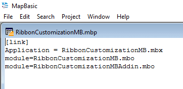
Note you can choose any name for your executable file although usually it relates to the program's application name. In the RibbonCustomizationMB.mbp the application name is the same as one of the (*.MBO) files: RibbonCustomizationMB.mbo. In the above example two files are linked to form the executable file.
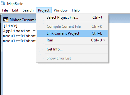
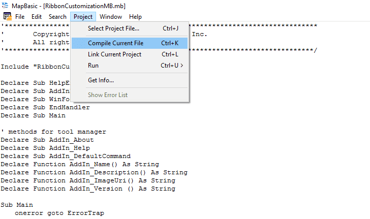
The link will succeed if both modules have been compiled as (*.MBO) files. Compile the RibbonCustomizationMB.mb file to create the (*.MBO).
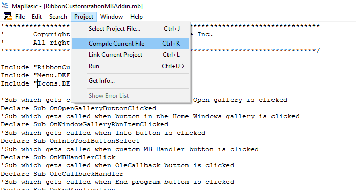
Then repeat the process with the RibbonCustomizationMBAddin.mb file.
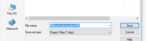
Save the file as a project file.
So to create an (*.MBP) file start by opening a new file within MapBasic. Then type [link] on the first line. On the next line type your chosen application name. Here in the following example the name chosen is Application = Anyname.mbx. So the format looks something like the following:-
[link]
Application = Anyname.mbx
module=yourfirstapp.mbo
module=yoursecondapp.mbo
module=yourthirdapp.mbo
Once this file has been successfully linked in MapBasic and saved as a project file (*.MBP) an executable file called Anyname.mbx is created which can be run within MapInfo Pro.
[link]
Application = Anyname.mbx
module=yourfirstapp.mbo
module=yoursecondapp.mbo
module=yourthirdapp.mbo
Once this file has been successfully linked in MapBasic and saved as a project file (*.MBP) an executable file called Anyname.mbx is created which can be run within MapInfo Pro.
 RSS Feed