Geographic Information Systems (GIS) have become an indispensable tool for professionals in various fields, from urban planning to environmental management. PHP, a versatile server-side scripting language, can be a valuable asset in building GIS applications. In this blog post, we'll explore the critical aspect of working with forms and user input in a GIS environment, focusing on the importance of validating and sanitizing user input for security. This guide is tailored for intermediate GIS users looking to enhance their PHP skills in this context.
Forms play a pivotal role in GIS applications, allowing users to input data, perform queries, and interact with maps. Whether you're creating a web-based GIS system or adding functionality to an existing one, PHP can help streamline the process of handling user input.
Form Validation: Ensuring Data Integrity
One of the primary responsibilities of a GIS application is to maintain data integrity. PHP's validation capabilities are invaluable in ensuring that users submit accurate and complete data. Here are some key considerations:
Client-side vs. Server-side Validation: While client-side validation can provide a smoother user experience, it's crucial to rely on server-side validation as the primary defence. Client-side validation can be bypassed, making server-side validation essential for security.
Data Type and Format Validation: Ensure that user input adheres to the expected data types and formats. For example, validate that latitude and longitude values are in the correct numerical format.
Range and Boundary Checks: Implement checks to ensure that input values fall within specified ranges. For instance, you can validate that a user-submitted coordinate lies within the geographic bounds of your map.
Input Sanitization: Guarding Against Security Threats
Beyond data integrity, security is a paramount concern when dealing with user input. Unsanitised user input can expose your GIS application to various vulnerabilities, including SQL injection and cross-site scripting (XSS) attacks. PHP offers several functions and techniques to mitigate these risks:
Escape User Input: Use functions like mysqli_real_escape_string or prepared statements when interacting with a database. This prevents malicious SQL injection attempts.
HTML Entity Encoding: When displaying user input on web pages, encode it using htmlspecialchars to prevent XSS attacks. This ensures that any potential HTML or JavaScript within the input is treated as plain text.
File Upload Security: If your GIS application allows file uploads, enforce strict controls, such as limiting file types and performing server-side validation to check the uploaded files' integrity.
Regular Expressions: Employ regular expressions to validate and sanitize complex input, such as email addresses or URLs.
Best Practices for GIS Developers
Here are some best practices for GIS developers working with PHP and user input:
1. Modular Code: Break your code into modular functions or classes to handle different aspects of form processing, validation, and sanitization. This promotes code reusability and maintainability.
2. Error Handling: Implement robust error handling mechanisms to gracefully handle validation errors and provide meaningful feedback to users.
3. Logging: Maintain comprehensive logs of user input, especially when dealing with sensitive data or potentially malicious input. This can assist in troubleshooting and security audits.
4. Regular Updates: Keep your PHP version and libraries up to date to benefit from the latest security patches and enhancements.
PHP can be a powerful ally for GIS developers when it comes to handling forms and user input. By mastering form validation and input sanitization techniques, you can not only ensure data integrity but also fortify your GIS application against security threats. Remember that security is an ongoing process, so stay vigilant and continuously update your knowledge to protect your GIS environment effectively.
In previous blog posts, we discussed the integration of PHP and JavaScript to create a Geographic Information System (GIS) form for entering latitude and longitude coordinates and displaying them on a map. Now, let's take it a step further by adding CSS (Cascading Style Sheets) to enhance the visual appeal and layout of our GIS form and map.
Code Example: Enhancing the GIS Form and Map
In this section, we'll provide you with a code example that demonstrates how to enhance your GIS form and map with CSS styling.
HTML Structure
Code Example: Enhancing the GIS Form and Map
In this section, we'll provide you with a code example that demonstrates how to enhance your GIS form and map with CSS styling.
HTML Structure
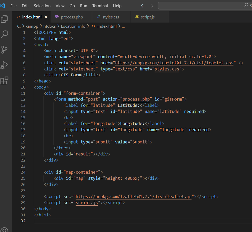
CSS Styling
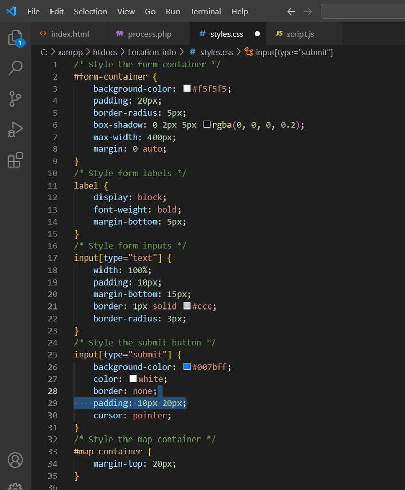
With these CSS enhancements, our GIS form now looks polished and professional, offering an improved user experience. Users will find it easier to input latitude and longitude coordinates, and the submit button is visually appealing.
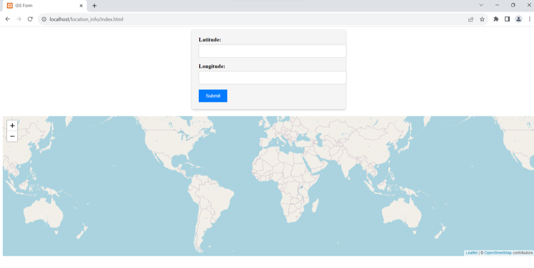
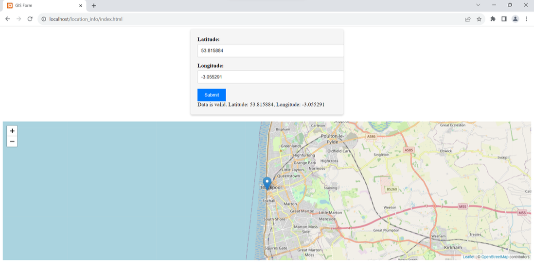
The map, situated below the form, maintains a clear separation between the two elements and provides a visual representation of the entered coordinates. When valid coordinates are submitted, the map updates to display the location accurately.
Incorporating CSS into your GIS application not only improves aesthetics but also contributes to a user-friendly interface, making it more accessible and engaging
 RSS Feed