Getting Started with the Python Console in QGIS: A Beginner's Guide
In this blog post, we'll explore a fundamental tool within QGIS - the Python Console - and guide you through its basics, step by step. Don't worry if you're new to Python or QGIS; we'll keep it beginner-friendly.
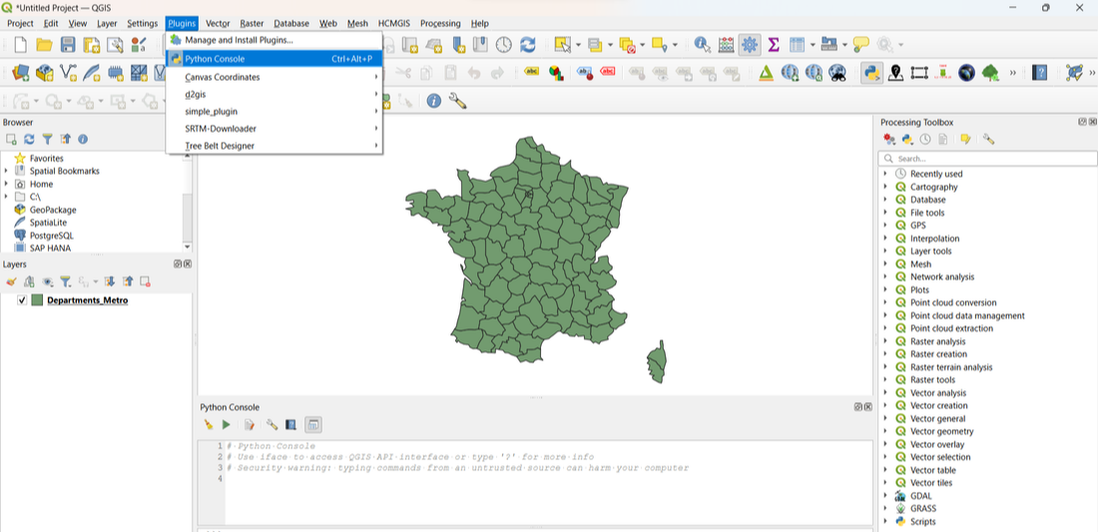
Step 1: Opening the Python Console
To access the Python Console in QGIS, follow these simple steps:
1. Launch QGIS.
2. Go to the "Plugins" menu.
3. Select "Python Console."
You'll see a new window at the bottom of your QGIS interface.
In this blog post, we'll explore a fundamental tool within QGIS - the Python Console - and guide you through its basics, step by step. Don't worry if you're new to Python or QGIS; we'll keep it beginner-friendly.
Step 1: Opening the Python Console
To access the Python Console in QGIS, follow these simple steps:
1. Launch QGIS.
2. Go to the "Plugins" menu.
3. Select "Python Console."
You'll see a new window at the bottom of your QGIS interface.
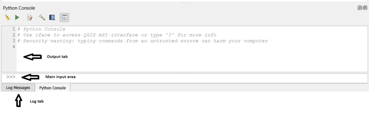
Step 2: Understanding the Python Console Interface
Before we start coding, let's understand the layout of the Python Console:
The main input area: This is where you'll write your Python code.
The "Output" tab: Displays the results of your code execution.
The "Log" tab: Shows any error messages or additional information.
Before we start coding, let's understand the layout of the Python Console:
The main input area: This is where you'll write your Python code.
The "Output" tab: Displays the results of your code execution.
The "Log" tab: Shows any error messages or additional information.
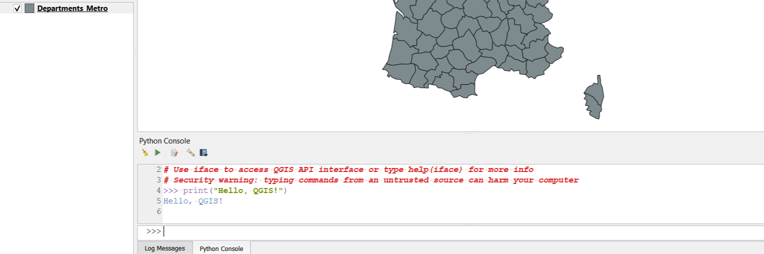
Step 3: Writing Your First Python Script
Now, let's write a simple Python script to get a feel for the Python Console. Type the following code into the input area:
Now, let's write a simple Python script to get a feel for the Python Console. Type the following code into the input area:
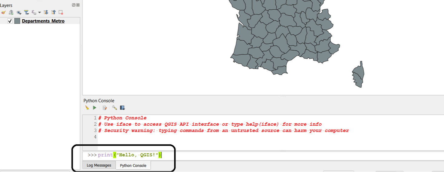
Press Enter, and you'll see "Hello, QGIS!" in the "Output" tab.
Step 4: Accessing QGIS Layers
One of the most powerful aspects of the Python Console in QGIS is its ability to interact with your GIS data. Let's start by accessing a layer. Suppose you have a layer named "Departments_Metro" You can access it like this:
One of the most powerful aspects of the Python Console in QGIS is its ability to interact with your GIS data. Let's start by accessing a layer. Suppose you have a layer named "Departments_Metro" You can access it like this:
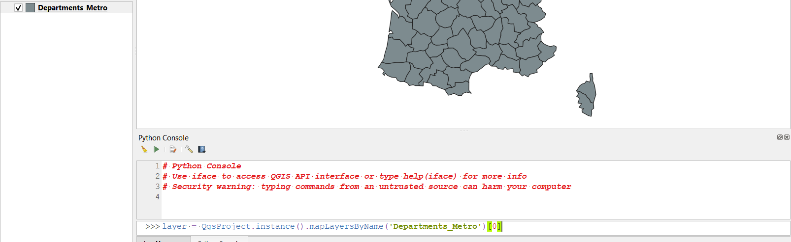
Here, we've created a variable 'layer' that contains our 'Departments_Metro' layer. Note that 'Departments_Metro' should be replaced with the name of your actual layer.
Step 5: Working with Features
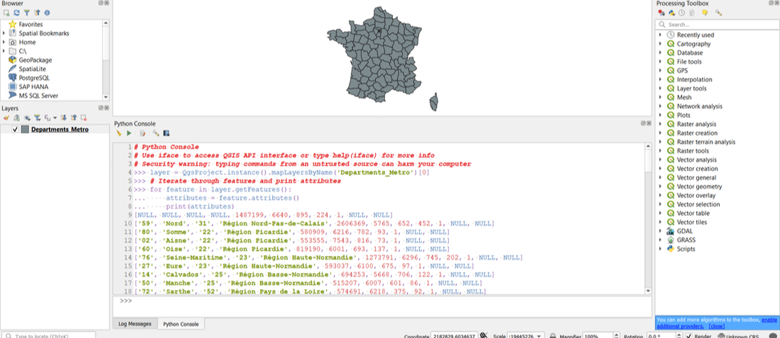
Now, let's work with the features within the 'Departments_Metro' layer. We'll iterate through the features and print their attributes:
Now, let's work with the features within the 'Departments_Metro' layer. We'll iterate through the features and print their attributes:
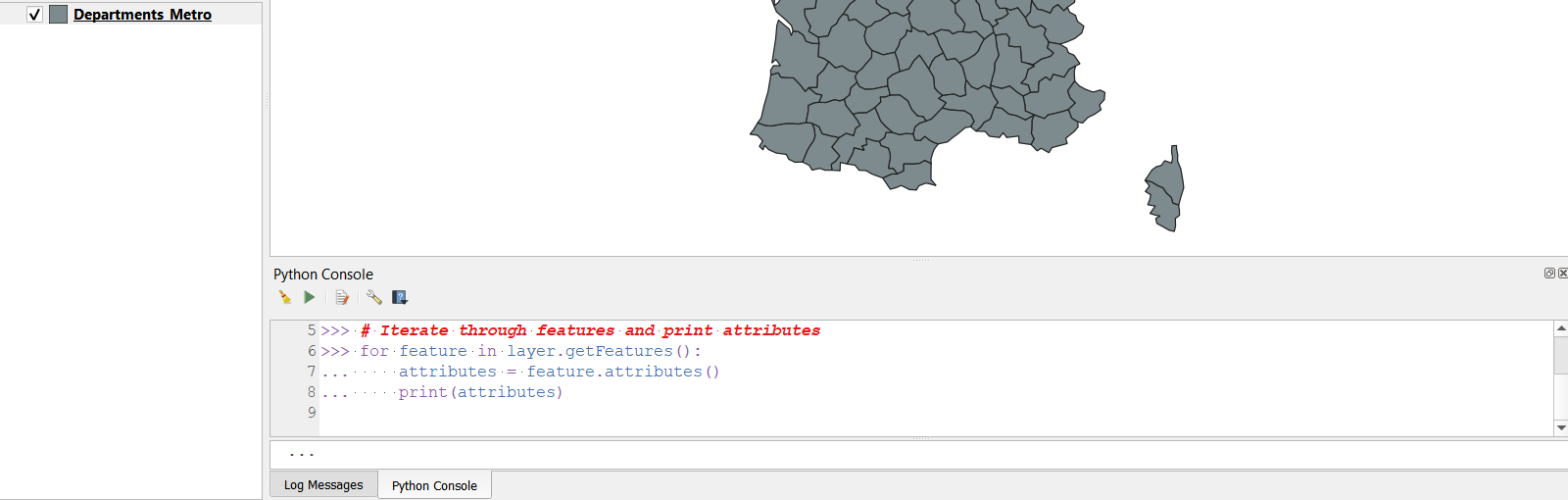
This code retrieves all the features in the 'Departments_Metro' layer and prints their attributes.
Step 6: Performing Spatial Operations
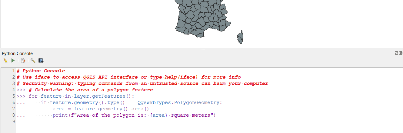
Python in QGIS also allows you to perform spatial operations. For example, you can calculate the area of a polygon feature:
Python in QGIS also allows you to perform spatial operations. For example, you can calculate the area of a polygon feature:
Here is the output from the above code:-
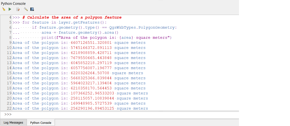
In this code, we check if a feature is a polygon and then calculate its area.
Step 7: Saving Your Work
The Python Console in QGIS is a versatile tool that empowers GIS specialists like you to automate tasks, manipulate data, and perform complex spatial analyses. In this beginner-friendly guide, we've covered the basics of opening the console, writing and running Python scripts, and interacting with GIS layers. As you continue your journey into the world of QGIS and Python, this knowledge will serve as a solid foundation for more advanced tasks in geographic information science.
 RSS Feed