If you are a complete beginner in the world of Geographic Information Systems (GIS) and looking to collect user input through web forms then this guide will take you through the basics of using PHP to create HTML forms for collecting user data. Whether you're building a GIS application, a survey tool, or any other web-based project, understanding how to create forms is an essential skill.
Why Use HTML Forms with PHP for GIS?
Before we dive into the nitty-gritty of building HTML forms with PHP, let's understand why this combination is so useful in the context of GIS applications.
1. User Interaction: GIS applications often require users to input location data, addresses, or other spatial information. HTML forms provide an interactive way for users to input this data.
2. Data Validation: PHP can be used to validate user input, ensuring that the data collected is accurate and adheres to predefined rules. This is crucial for maintaining data quality in GIS.
3. Data Processing: Once the user submits the form, PHP can process the data, perform calculations, or interact with GIS databases to generate relevant maps, reports, or visualisations.
4. Customisation: Using PHP, you can customise the form's appearance and behaviour to suit your specific GIS project's needs.
Now that we understand the importance of using PHP and HTML forms in GIS, let's look at the step-by-step process of creating one.
Step 1: Setting Up Your Development Environment
Before you start building your HTML form with PHP, make sure you have a development environment set up. You'll need a web server (like Apache), PHP installed, and a text editor for coding (e.g., Visual Studio Code, Sublime Text).
Step 2: Creating the HTML Form
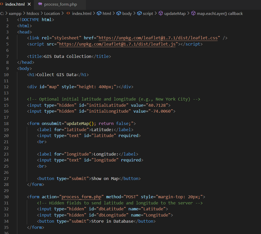
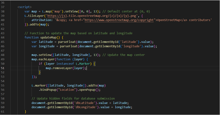
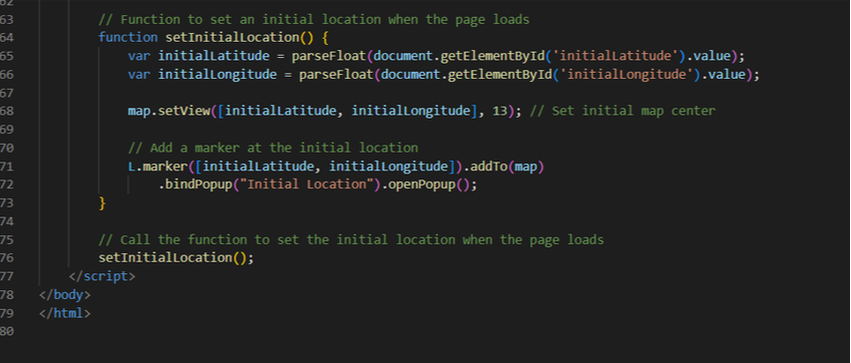
Begin by creating an HTML file (e.g., index.html) and add the following code to create a simple form:
Why Use HTML Forms with PHP for GIS?
Before we dive into the nitty-gritty of building HTML forms with PHP, let's understand why this combination is so useful in the context of GIS applications.
1. User Interaction: GIS applications often require users to input location data, addresses, or other spatial information. HTML forms provide an interactive way for users to input this data.
2. Data Validation: PHP can be used to validate user input, ensuring that the data collected is accurate and adheres to predefined rules. This is crucial for maintaining data quality in GIS.
3. Data Processing: Once the user submits the form, PHP can process the data, perform calculations, or interact with GIS databases to generate relevant maps, reports, or visualisations.
4. Customisation: Using PHP, you can customise the form's appearance and behaviour to suit your specific GIS project's needs.
Now that we understand the importance of using PHP and HTML forms in GIS, let's look at the step-by-step process of creating one.
Step 1: Setting Up Your Development Environment
Before you start building your HTML form with PHP, make sure you have a development environment set up. You'll need a web server (like Apache), PHP installed, and a text editor for coding (e.g., Visual Studio Code, Sublime Text).
Step 2: Creating the HTML Form
Begin by creating an HTML file (e.g., index.html) and add the following code to create a simple form:
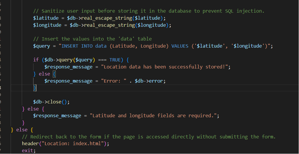
Step 3: Creating the PHP Script
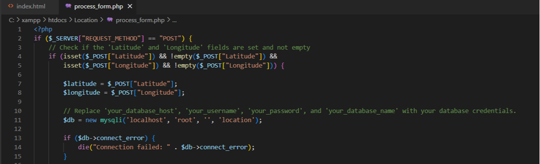
Create a new PHP file (e.g., process_form.php) to handle the form submission and data processing:
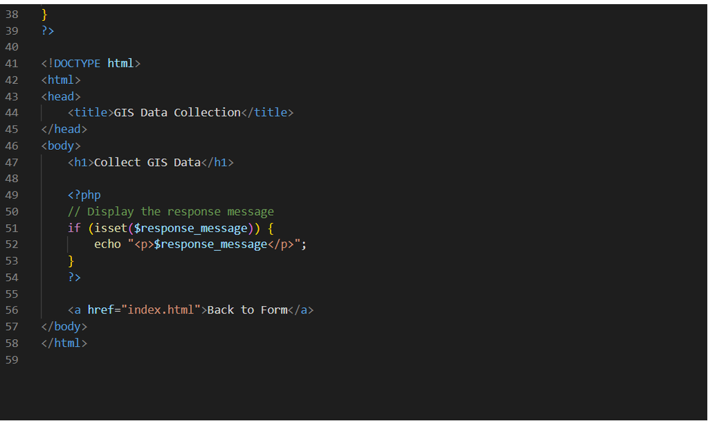
In this script, you can access the data submitted from the form using the `$_POST` superglobal. You can then perform any necessary validation or processing.
Create a new PHP file (e.g., process_form.php) to handle the form submission and data processing:
In this script, you can access the data submitted from the form using the `$_POST` superglobal. You can then perform any necessary validation or processing.
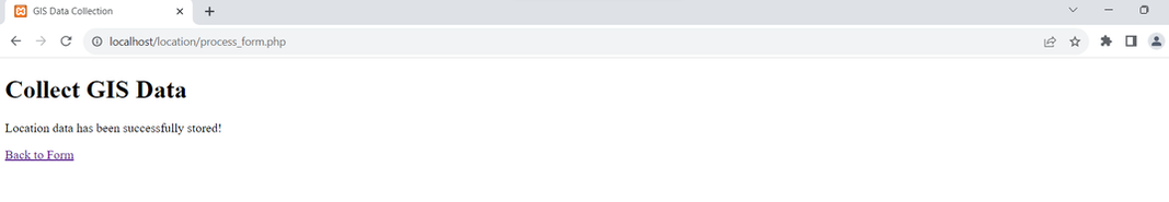
Step 4: Testing Your Form
Start your web server and open your HTML form in a web browser (e.g., http://localhost/Location/index.html). Submit some data through the form to test it.
Start your web server and open your HTML form in a web browser (e.g., http://localhost/Location/index.html). Submit some data through the form to test it.
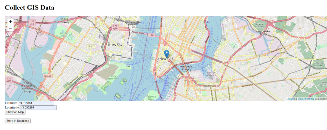
The user enters latitude and longitude to take the map from the default landing page to Blackpool!
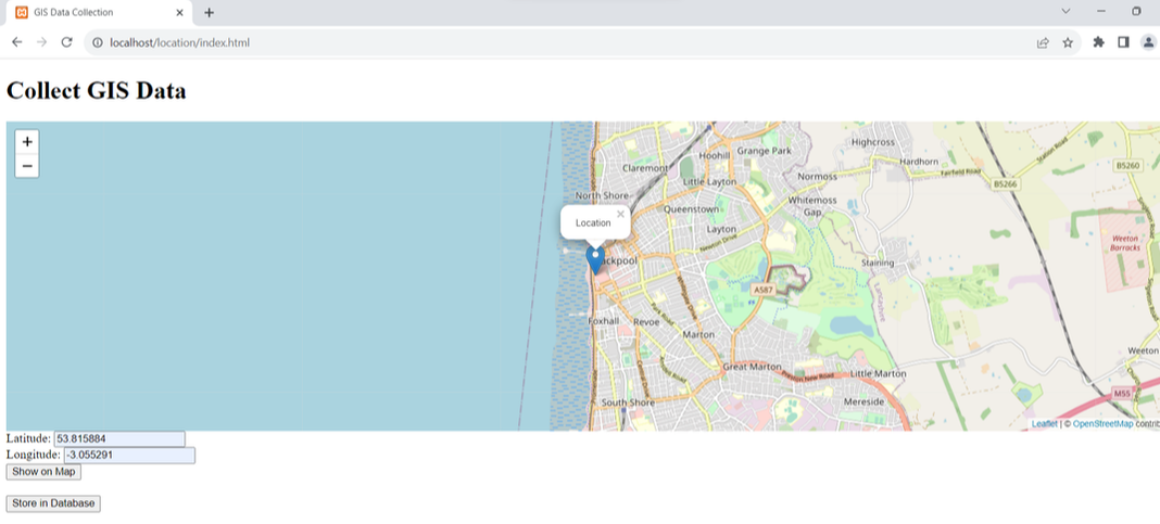
By clicking on the Show on Map button the user is taken to the Blackpool map.
Clicking on the Store in Database button will save the latitude and longitude to a database.
Step 5: Further Enhancements
As you become more comfortable with PHP and HTML forms, you can enhance your GIS application by adding features like data storage, user authentication, and more advanced form elements.
These are your first steps toward collecting user input for your GIS project using PHP and HTML forms. With practice, you'll be able to build more sophisticated forms and create powerful GIS applications that efficiently gather and process spatial data.
 RSS Feed